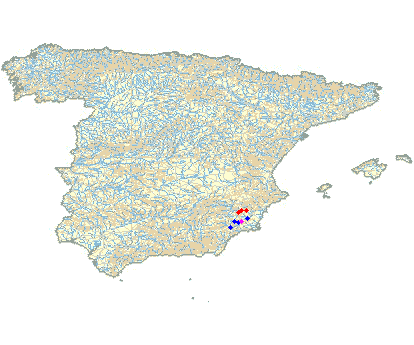
GESCHLOSSEB/CLOSED Carrascoy, 820 Meter
|
|
| Talort: |
Sangonera La Verde, 180 Meter |
| Höhenunterschied: |
641
Meter |
| Streckenflug: |
Ja |
| Seilbahn: |
Nein |
| Windenschlepp: |
Nein |
| Walk and Fly: |
Nein |
| GPS Tal: |
37° 52' 29.59'' N,1° 18' 21.47'' W |
| GPS Berg: |
37° 51' 2.506'' N,1° 17' 22.29'' W |
|
Carrascoy is closed for undefined time. Dispute with the owner of the take off. We are not allowed to drive up the mountain any more.
I will let paragliding 365 know if anything changes in our favour.
|
|
Flug
Kontakt: Club Parapente Espuña, Tel.: +34 (0) 968282996 (Isidoro)
oder
www.doyouwanna.net
Nick 0034 606 781 180
|

    
|
|
 |
|
4 Votes
|
1637 Hits
|
| [doyouwanna] |
| Overlooking take off.
This site closed during hunting season. Please call locals or us.
We are not allowed to fly right of take off any more, due to birds nesting. Every now and then there are new regulations. Check before you fly this one.
Last winter 2006, it was not only closed till the end of March,but till the end of july. Mos probably due to foreign pilots flying the site not knowing it wasn't open yet. They flew only a few days before it was opened. Club parapente Murcia can tell you all about it. |
|
Mehr Bilder ansehen
|
Startplätze |
| Startplatz: |
La Muela |
| GPS-Koordinaten: |
37° 51' 2.50'' N,1° 17' 22.29'' W |
| Startrichtung: |
NO/N/NW |
| Schwierigkeit: |
mittel
|
| Höhe über NN: |
810 |
|
|
|
|
|
|
|
Landeplätze |
| Landeplatz: |
Carrascoy |
| GPS-Koordinaten: |
37° 52' 33'' N,1° 18' 14'' W |
| Schwierigkeit: |
mittel
|
| Höhe über NN: |
169 |
|
|
|
|
|
|
|
Umgebungskarte

Interaktive Karte
|
Fluggebiete in der Nähe (Radius: 50 km) |
|
Europa » Spanien » Kastilien-Leon
Cuesta Alta, 860 Meter

| Entfernung: | 34 km
|
|
Höhenuntersch.:
|
551
Meter
|
| Ort: | Cabezon de Pisuerga
|
| Streckenflug: | Nein
|
| Startplatz: |
mittel
|
| Landeplatz: |
mittel
|
Valladolid heißt die spanische Provinz, in der sich Cabezon de Pisuerga/Cuesta Alta befindet. Das Gebiet eignet sich für Piloten mittleren...
|
|
|
Europa » Spanien » Murcia
Hoya del Campo, 1261 Meter
Adopted by: [doyouwanna]
| Entfernung: | 42 km
|
|
Höhenuntersch.:
|
964
Meter
|
| Ort: | La Pila
|
| Streckenflug: | Nein
|
| Startplatz: |
mittel
|
| Landeplatz: |
mittel
|
Das Gebiet Hoya del Campo/La Pila liegt unweit von Murcia in der gleichnamigen spanischen Provinz. 475 m Höhendifferenz haben Gleitschirmpiloten...
|
|
|
Europa » Spanien » Valencia
Fortuna / Caprés, 740 Meter
Adopted by: [Makmak]
| Entfernung: | 43 km
|
|
Höhenuntersch.:
|
260
Meter
|
| Ort: | Caprés
|
| Streckenflug: | Nein
|
| Startplatz: |
Keine Angabe
|
| Landeplatz: |
Keine Angabe
|
Thermic site, lovely for flying in summer and late afternoons. Easterlie, southeasterly facing.
|
|
|
|
Flugschulen in der Nähe (Radius: 50 km) |
|
Europa » Spanien » Murcia
CLUB DE PARAPENTE VUELO LIBRE
CLUB DE PARAPENTE VUELO LIBRE
ALHAMA MOLINO, 50
30840 ALHAMA DE MURCIA
Entfernung: 10 km
Der Club ist vor allem in Südspanien unterwegs.
|
|
|
Europa » Spanien » Murcia
MURCIA CLUB DE PARAPENTE SURESTE
MURCIA CLUB DE PARAPENTE SURESTE
SENDA DE ENMEDIO, 10-1º-F
30009 MURCIA
Entfernung: 21 km
Der Club ist vor allem in Südspanien unterwegs.
|
|
|
Europa » Spanien » Murcia
Club Parapente Espuña
Clublokal ist in der Bar Legis
C/ Ronda de Garay Nº 7 Murcia
www.famur.org/~espuna
Entfernung: 23 km
Der Club mit angegliederter Schule wurde 1987 gegründet und fliegt u. a. auf folgenden Gebieten: La Muela, La Pila, El Caroche, Carrascoy und Pena...
|
|
|
|
|
|  |
|