Alt de Sella, 1058 Meter
|
|
| Talort: |
Sella, 377 Meter |
| Höhenunterschied: |
673
Meter |
| Streckenflug: |
Nein |
| Seilbahn: |
Nein |
| Windenschlepp: |
Nein |
| Walk and Fly: |
Nein |
| GPS Tal: |
38° 36' 30.79'' N,0° 16' 2.221'' W |
| GPS Berg: |
38° 37' 24.87'' N,0° 16' 4.411'' W |
|
Sella befindet sich in der spanischen Provinz Alicante. 600 m Höhendifferenz sind zu überwinden, am Besten von Gleitschirmpiloten, die ein wenig Erfahrung mitbringen.
Seit 2003 kein Landesplatz mehr in Tal. Nur toplanden...
auch der Startplatz ist jetzt verkauft. Dieses Fluggebiet existiert leider nicht mehr ...
Good news : We do fly Sella again. Although we need to get some kind of permission from the owner of the take off each time. So fly with us and we'll take you there. New landing field, I would say have some experience to fly Sella, landing field could be small for some of us. Hope to see you all. Nick Doyouwanna
.
|
|
Flug
www.doyouwanna.net
|

    
|
|
 |
|
3 Votes
|
2180 Hits
|
| [doyouwanna] |
| Before it was 'closed' we used to fly towards Puig Campana.
Nowadays we can't fly this site any more, due to no more landing ...
And the take off is bought by a not-spaniard who doesn't like paragliding. Too bad, we lost one of our first paragliding sites in the region. |
|
    
|
|
 |
|
1 Votes
|
975 Hits
|
| [doyouwanna] |
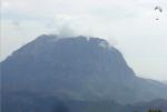
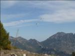
| Fluing off Sella with Puig Campana in front of you. One of the most impressive sites near Alicante. |
|
|
Startplätze |
| Startplatz: |
Alt de Sella (PRIVATGELÄNDE!!) |
| GPS-Koordinaten: |
38° 37' 24.87'' N,0° 16' 4.411'' W |
| Startrichtung: |
S/SO |
| Schwierigkeit: |
mittel
|
| Höhe über NN: |
1050 |
|
Privatgelände! Nutzung nur mit Guide!
|
|
|
|
|
|
Landeplätze |
| Landeplatz: |
Sella |
| Schwierigkeit: |
mittel
|
| Höhe über NN: |
0 |
|
|
|
|
|
|
|
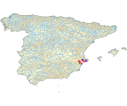
Umgebungskarte

Interaktive Karte
|
Fluggebiete in der Nähe (Radius: 50 km) |
|
Europa » Spanien » Valencia
Mola d'Ares, 844 Meter
Adopted by: [doyouwanna]
| Entfernung: | 8 km
|
|
Höhenuntersch.:
|
140
Meter
|
| Ort: | Ares
|
| Streckenflug: | Nein
|
| Startplatz: |
mittel
|
| Landeplatz: |
mittel
|
Mola d'Ares liegt in der Provinz Castellon und eignet sich am Besten für Piloten auf mittlerem Niveau. 450 m Höhendifferenz sind zu bewältigen.
|
|
|
Europa » Spanien » Valencia
Terra Mitica, 372 Meter
Adopted by: [name]
| Entfernung: | 11 km
|
|
Höhenuntersch.:
|
178
bis
354
Meter
|
| Ort: | Benidorm - Sierra de Cortina
|
| Streckenflug: | Nein
|
| Startplatz: |
leicht
|
| Landeplatz: |
mittel
|
Soaringgebiet entlang eines zirka 2 Kilometer langen Bergrückens. Das Fliegen würde ich als einfach einschätzen. Windrichtung: Süd...
|
|
|
Europa » Spanien » Valencia
Almudaina, 950 Meter
Adopted by: [doyouwanna]
| Entfernung: | 17 km
|
|
Höhenuntersch.:
|
0
Meter
|
| Ort: | Almudaina
|
| Streckenflug: | Nein
|
| Startplatz: |
mittel
|
| Landeplatz: |
mittel
|
Almudaina liegt in der südostspanischen Provinz Alicante. Das Fluggebiet bietet eine Höhendifferenz von 400 m und eigent sich am Besten für...
|
|
|
|
Flugschulen in der Nähe (Radius: 50 km) |
|
Europa » Spanien » Valencia
Club Alt de Sella
Entfernung: 3 km
Der Club Alt de Sella fliegt vor allem in der Gegend um Alicante.
|
|
|
Europa » Spanien » Valencia
CENTRO EXCURSIONISTA MURO
CENTRO EXCURSIONISTA MURO
APARTADO DE CORREOS NUM. 78
3830 MURO DE ALCOY
Entfernung: 21 km
Der Club ist vor allem in Südspanien unterwegs.
|
|
|
Europa » Spanien » Valencia
CLUB MONTE TOIX DOCTOR FLEMING
CLUB MONTE TOIX DOCTOR FLEMING,
EDIF.APOLO IV,local 7 3710 CALPE
Entfernung: 28 km
Der Club fliegt vorrangig in Südspanien.
|
|
|
|
|
|  |
|