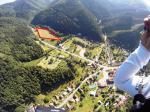
Krizna, 1574 Meter
|
|
| Talort: |
Banska Bystrica, 331 Meter |
| Höhenunterschied: |
1243
Meter |
| Streckenflug: |
Ja |
| Seilbahn: |
Nein |
| Windenschlepp: |
Nein |
| Walk and Fly: |
Ja |
|
|
Herrlich gelegene Flugseite bei Banska mit entsprechender Höhe im Gebirge.
|
|
Flug
In Spring take care on strong thermals, otherwise there is no complication.
Schwierigkeit
Die Slowakei, im Zentrum Europas gelegen, bietet mit dem Tatra-Gebirge und vielen anderen Naturschönheiten lohnende Reiseziele. Im Zuge des Zusammenbruchs des Ostblocks ist die Republik 1993 als der ökonomisch weniger entwickelte Teil aus der ehemaligen Tschechoslowakei entstanden. Politisch und wirtschaftlich befinden sich die Slowaken jetzt auf dem Wege in die europäische Union.
Besonderheiten und Webcam
Kontakt vor Ort über:
Školiace stredisko v Novom Meste nad Váhom
Nálepkova 16
915 01 Nové Mesto nad Váhom
GPS pozícia: N 48° 45,286' E 17° 49,873'
tel./fax : 00 421 32 7715447
mobil : 0904 453 466
e-mail: ivo-sia@nm.psg.sk |
Walk and Fly
| Ausgangspunkt: |
2 routes -
1,Turecká 605m / Krízna 1575 follow ski slope and yelow mark (Time with light equipment 50min -70min)
2, Stare Hory 460m/ Krizna 1575 follow blue mark (Time with light equipment 2hours) |
| Wegbeschreibung: |
1, Route is steep and fast, but someone must land in Turecka and take your car back down. Landing on parking Salasky (780m) is very demanding, better way is to fly down to the walley of Stare Hory and land on a huge and long field behind the village
2, Route is very long but offers beautifull land wievs from the upper part. Follov the mark and dont make shortcuts because of many dirt forest roads wich can blame you. |
| Sonstiges: |
There is a posiibility to see many wild animals, especialy in the early morning. There is more than 3000 bears in Slovakia, so take care and listen to the forest. |
Wissenswertes
| Seilbahn: |
There was one, but after 1992 was eliminated. Upper station is still on the place but after 2005 after big fire its just burned. |
| Fliegertreff: |
1, Stare Hory
2, Turecka |
| Unterkunft: |
Donovaly, Stare Hory, Turecka |
| Anfahrt: |
Das Fluggebiet befindet sich nahe Banska. |
| Sonstiges: |
In der Slowakischen Republik herrscht ein kontinentales Klima mit warmen Sommern und kalten Wintern. Die durchschnittliche Temperatur im Juli liegt bei 30 °C, im Januar bei -2 °C. |
|

    
|
|
 |
|
1 Votes
|
658 Hits
|
| [mefisto] |
| In Flight. Landing place Stare Hory 460m visible. Take care on high voltage on both sides of the landing place! |
|
    
|
|
 |
|
0 Votes
|
583 Hits
|
| [mefisto] |
| Krizna is a big ridge upon the Valley of Banska Bystrica (10km toward Donovaly). Great Fly and Hike mountain, height diference from 650 - 1200 vertical - it dipence from your hiking start point. West side of Krizna is forbiden for paragliding because of several protected Bird species. |
|
Mehr Bilder ansehen
|