Stirlings, 1300 Meter
          
Talort:
Albany
Höhe Talort:
84 Meter
Höhenunterschied:
1050
Meter
Start Richtungen:
Seilbahn:
Nein
Streckenflug:
Ja
Soaring:
Keine Angabe
Windenschlepp:
Nein
Walk and Fly:
Nein
Ski and Fly:
Nein
Drachen:
Keine Angabe
UL:
Keine Angabe
Google Maps:
Qualität Fluggebiet:
Qualität dieser Seite:
Statistik:
Adoption (User):
-
Zuletzt bearbeitet:
06.01.2006
Many want to fly here, few have tried until now. The highest mountain in the south west of Australia usually appears very windy almost storm-like. Therefore Paragliding was forbidden by the National Park Ranger. (As of May 2004). A site only for pros!
Bewertung der Fluggebiets- und der Seitenqualität
Flug
Bluff Knoll is a smooth cliff with difficult access at the mountain. There is somewhat further possibilities on the right side to start.
Wissenswertes
Anfahrt:
You will find the Stirling Range National Park approx. 100km North of Albany. Take the Albany Highway down in the direction of Kojonup, and follow the signs.
Sonstiges:
Albany is 400km south of Perth. It is a large coastal region with all wind directions. It is know as one of the best flying locations in Western Australia if you want to spend a couple of crazy hours in the air.
Startplätze
Startplatz:
Bluff Knoll
Startrichtung:
Schwierigkeit:
sehr schwer
Höhe über NN:
1300
Den Startplatz findet ihr von der Chester Pass Road aus. Einfach den Schildern folgen. Vom Parkplatz aus steht ein Schild mit folgenden Wortlaut: "Bis zum Bluff Knoll 3 Stunden Aufstieg ohne Gepäck!" Viel Vergnügen...
|
Landeplätze
Landeplatz:
Bluff Knoll Car Park
Schwierigkeit:
schwer
Höhe über NN:
250
Der Nationalpark bietet mehrere Landeplätze an, die jedoch meist als Parkplätze genutzt werden. Sinnvoller ist es, die Thermik zu nutzen und weit dahinter versuchen zu landen.
|
Download: Google Earth Dateien für Fluggebiet und Flugdaten (IGC, OLC)
Download: Google Earth Dateien (KML-Format), Flugdaten (IGC Format)
Die letzten 3 Flüge
Leider keine OLC Daten vorhanden.
Flugdaten von www.paraglidingforum.com
Leider keine OLC Daten von www.paraglidingforum.com vorhanden.
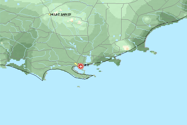
Umgebungskarte
  Fluggebiet  Flugschule  Aktuelle Position | Orte in der Nähe
Albany (2 km)
Green Island (6 km)
Cuthbert (8 km)
Seal Island (10 km)
King River (11 km)
Green Island (11 km)
Albany Aerodrome (12 km)
Grasmere (13 km)
Grassmere (13 km)
Stony Island (14 km)
Michaelmas Island (15 km)
Elleker (15 km)
Torbay Junction (15 km)
Breaksea Island (15 km)
Marbellup (16 km)
|
Fluggebiete in der Nähe (Radius: 50 km)
Australien / Ozeanien » Australien » Western Australia
Entfernung:
0 km
Höhenuntersch.:
-64
Meter
Ort:
Albany
Streckenflug:
Ja
Startplatz:
mittel
Landeplatz:
schwer
Start Richtungen:
In the heart of Albany you will get a great view of the site from the starting place Circumstance guarantees one orderly and quiet flight with a crazy look over the harbor, the city and Fort Adelaide.
Australien / Ozeanien » Australien » Western Australia
Entfernung:
0 km
Höhenuntersch.:
0
Meter
Ort:
Albany
Streckenflug:
Ja
Startplatz:
mittel
Landeplatz:
schwer
Start Richtungen:
Large site with over 10km long, strong falling away Front with no possibilities to land below, as the slope ends directly in the ocean.
Australien / Ozeanien » Australien » Western Australia
Entfernung:
0 km
Höhenuntersch.:
-59
Meter
Ort:
Albany
Streckenflug:
Nein
Startplatz:
sehr leicht
Landeplatz:
sehr leicht
Start Richtungen:
One of Western Australia's quietest and steadiest flight zones. Suited well for the beginner, for it always offers landing possibilities below on the beach.
The slight height of the dunes enables you to fly even in stong wind conditions.
Flugschulen in der Nähe (Radius: 50 km)
Australien / Ozeanien » Australien » Western Australia
Jeder ist willkommen, der ein mutiger Paraglider oder Drachenflieger werden will. Alles weitere auf Anfrage!
Alle Fluggebiete und Flugschulen in der Nähe anzeigen
|