Brunswick Junction, 200 Meter
          
Talort:
Margaret River
Höhe Talort:
2 Meter
Höhenunterschied:
198
Meter
Start Richtungen:
Seilbahn:
Nein
Streckenflug:
Ja
Soaring:
Keine Angabe
Windenschlepp:
Nein
Walk and Fly:
Nein
Ski and Fly:
Nein
Drachen:
Keine Angabe
UL:
Keine Angabe
Google Maps:
Qualität Fluggebiet:
Qualität dieser Seite:
Statistik:
Adoption (User):
-
Zuletzt bearbeitet:
13.12.2005
A high west facing mountain with good thermic conditions.
Bewertung der Fluggebiets- und der Seitenqualität
Flug
The starting place on the mountain sits on top of a hill and is rather small. It is difficult to start high and wide flights. It is better to start on the highest point below the peak. There is good flying potential of up to 100km wide, when you can get a side wind.
Besonderheiten und Webcam
| It is best to contact the local "Cloudbase Paragliding Club" and make the first flight another paraglider that knows the site and conditions well. Then the land is privately owned and should not be entered therefore without prior arrangement, otherwise it will be closed to paragliders. Moreover the keys must be picked up from the owner of the land! |
Wissenswertes
Anfahrt:
You will find Darling Range south of Brunswick Junction on the South-Western Highway.
Sonstiges:
You will find Margaret River in the middle region of Bunbury and Cape Naturaliste, approx. 200km south of Perth. This lovely landscape offers all wind directions available at the coast side, by NE over W until S. The best time to fly is in the spring or autumn so to exploit the advantages of the western back wind or front wind. Also in the summer, flights over the lake are yet always very good.
Startplätze
Startplatz:
Brunswick Junction
Startrichtung:

W Schwierigkeit:
schwer
Höhe über NN:
200
|
Landeplätze
Landeplatz:
Darling Range
Schwierigkeit:
leicht
Höhe über NN:
0
Besser vor den Zäunen der Farm landen wegen den Hunden!
|
Download: Google Earth Dateien für Fluggebiet und Flugdaten (IGC, OLC)
Download: Google Earth Dateien (KML-Format), Flugdaten (IGC Format)
Die letzten 3 Flüge
Leider keine OLC Daten vorhanden.
Flugdaten von www.paraglidingforum.com
Leider keine OLC Daten von www.paraglidingforum.com vorhanden.
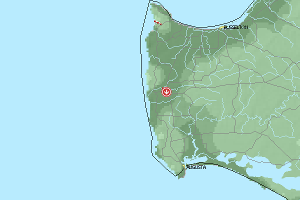
Umgebungskarte
  Fluggebiet  Flugschule  Aktuelle Position | Orte in der Nähe
Margaret River (0 km)
Bramley (6 km)
East Witchcliffe (9 km)
Cowaramup (9 km)
Witchcliffe (10 km)
Rosa Brook (11 km)
Forest Grove (13 km)
Yates, Mount (19 km)
Metricup (19 km)
Yelverton (22 km)
Arumvale (24 km)
Yallingup (28 km)
Karridale (30 km)
Carbunup (30 km)
Hamelin Island (30 km)
|
Fluggebiete in der Nähe (Radius: 50 km)
Australien / Ozeanien » Australien » Western Australia
Entfernung:
0 km
Höhenuntersch.:
8
Meter
Ort:
Margaret River
Streckenflug:
Ja
Startplatz:
sehr leicht
Landeplatz:
sehr leicht
Start Richtungen:
A long and flat section of coast with a soft sandy beach. In a western wind its possible to land on the naked bathers beach.
Australien / Ozeanien » Australien » Western Australia
Entfernung:
0 km
Höhenuntersch.:
8
Meter
Ort:
Margaret River
Streckenflug:
Ja
Startplatz:
sehr leicht
Landeplatz:
sehr leicht
Start Richtungen:
Very nice and beautiful coast with a lond beach- and naked beach. Mostly west winds!
Australien / Ozeanien » Australien » Western Australia
Entfernung:
0 km
Höhenuntersch.:
0
Meter
Ort:
Margaret River
Streckenflug:
Ja
Startplatz:
sehr leicht
Landeplatz:
Keine Angabe
Start Richtungen:
A long and flat cut of caost with a beautiful white beach. In a west wind it is possible to land on the naked bathers beach.
Alle Fluggebiete und Flugschulen in der Nähe anzeigen
|