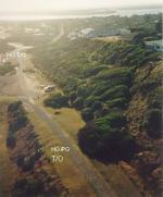
Bells Beach, 30 Meter


Talort:
Torquay
Höhe Talort:
0 Meter
Höhenunterschied:
30
Meter
Start Richtungen:
Seilbahn:
Nein
Streckenflug:
Ja
Soaring:
Keine Angabe
Windenschlepp:
Nein
Walk and Fly:
Nein
Ski and Fly:
Nein
Drachen:
Keine Angabe
UL:
Keine Angabe
Google Maps:
Qualität Fluggebiet:
Qualität dieser Seite:
Statistik:
Adoption (User):
-
Zuletzt bearbeitet:
10.12.2005
For the Paraglider this coastal fliying site always offers SSE, SE winds.
Bewertung der Fluggebiets- und der Seitenqualität
Flug
Please do not land at the south side of the beach, due to the businesses located there. Also, top landings are only possible on the free cliff (400m), south of the starting area. Heading north you can also land on the Jan Juc Beach.
Besonderheiten und Webcam
Please contact:
The Dynasoarers Hang Gliding Club
Ted Remeika +61 412 841 107. |
Wissenswertes
Anfahrt:
You will find this site near Torquay overlooking the beach. Take-off site for the Paraglider is the Southside parking lot. Please find a sketch at http://www.vhpa.org.au
Sonstiges:
You will find Torquay in the Surfing capital of Australia located 100km from Melbourne. Easy to reach, simply follow the Great Ocean Road from Melbourne.
Startplätze
Startplatz:
Bells Beach
Startrichtung:

O SO Schwierigkeit:
schwer
Höhe über NN:
30
|
Landeplätze
Landeplatz:
Bells Beach
Schwierigkeit:
leicht
Höhe über NN:
0
|
Download: Google Earth Dateien für Fluggebiet und Flugdaten (IGC, OLC)
Download: Google Earth Dateien (KML-Format), Flugdaten (IGC Format)
Die letzten 3 Flüge
Leider keine OLC Daten vorhanden.
Flugdaten von www.paraglidingforum.com
Leider keine OLC Daten von www.paraglidingforum.com vorhanden.
Umgebungskarte
  Fluggebiet  Flugschule  Aktuelle Position | Orte in der Nähe
Torquay (0 km)
Bellbrae (4 km)
Jan Jue (4 km)
Freshwater Creek (8 km)
Mount Duneed (9 km)
Connewarre (10 km)
Pettavel (13 km)
Waurn Ponds (13 km)
Grovedale (15 km)
Marshalltown (15 km)
Marshall (15 km)
Anglesea River (16 km)
Anglesea (16 km)
Barwon Heads (17 km)
Moriac (17 km)
|
Fluggebiete in der Nähe (Radius: 50 km)
Australien / Ozeanien » Australien » Victoria
Entfernung:
16 km
Höhenuntersch.:
84
Meter
Ort:
Anglesea
Streckenflug:
Ja
Startplatz:
schwer
Landeplatz:
schwer
Start Richtungen:
Steep falling away cliff, used mostly by Hang Gliders. There are always people here and there is alot of air traffic. It is also suited for the paraglider.
Australien / Ozeanien » Australien » Victoria
Entfernung:
20 km
Höhenuntersch.:
-275
Meter
Ort:
Geelong
Streckenflug:
Ja
Startplatz:
mittel
Landeplatz:
mittel
Start Richtungen:

|
15.07.2016
|
 |
|
0 Votes
|
800 Hits
|
| [taggi] |
| ©www.vhpa.org.au |
|
Lovley coastal flying site with sand dunes from Coastal Collendina to Point Lonsdale. The height of the dunes ranges from 2 to 15 Metres.
Australien / Ozeanien » Australien » Victoria
Entfernung:
20 km
Höhenuntersch.:
13
Meter
Ort:
Geelong
Streckenflug:
Ja
Startplatz:
Keine Angabe
Landeplatz:
Keine Angabe
Start Richtungen:
Coastal flying site near Geelong. This site has been closed since November 1999 due to dune erosion. (As of 2004!)
Alle Fluggebiete und Flugschulen in der Nähe anzeigen


