Mt. Nebo, 450 Meter
          
Talort:
Dardanelle
Höhe Talort:
90 Meter
Höhenunterschied:
360
Meter
Start Richtungen:
Seilbahn:
Nein
Streckenflug:
Ja
Soaring:
Keine Angabe
Windenschlepp:
Nein
Walk and Fly:
Nein
Ski and Fly:
Nein
Drachen:
Keine Angabe
UL:
Keine Angabe
GPS Tal:
Qualität Fluggebiet:
Qualität dieser Seite:
Statistik:
Adoption (User):
-
Zuletzt bearbeitet:
12.01.2006
The mountain raises over the Arkansas River and was once very popular for steam boats -and an outlook point. Today the Mt offers. Nebo State Park an outstanding infrastructure for vacationers with numerous campgrounds and Bungalows.
Bewertung der Fluggebiets- und der Seitenqualität
Flug
For all flight friends, the Nebo offers three start places and is therewith the well most multilateral mountain in Arkansas. The furthest flight went over 100 miles to Leflore.
Schwierigkeit
The Mountain has a middle difficulty rating (Hang 3 rating). You must contact the State Park prior to flying.
Info:Mt. Nebo State Park
Route 3, Box 374
Dardanelle, AR 72834
CAMPSITE RESERVATIONS: (501) 229-3655
www.arkansasstateparks.com
Startplätze
Startplatz:
Launch
Startrichtung:

S Schwierigkeit:
mittel
Höhe über NN:
450
Anfahrt erfolgt über den Highway 155 von Dardanelle. Die anderen beiden Starts gehen nach Ost und Nordost.
|
Landeplätze
Landeplatz:
Landing Zone
Schwierigkeit:
mittel
Höhe über NN:
90
Der Landeplatz am Fuße des Starts ist nicht sonderlich gross.
|
Download: Google Earth Dateien für Fluggebiet und Flugdaten (IGC, OLC)
Download: Google Earth Dateien (KML-Format), Flugdaten (IGC Format)
Die letzten 3 Flüge
Leider keine OLC Daten vorhanden.
Flugdaten von www.paraglidingforum.com
Leider keine OLC Daten von www.paraglidingforum.com vorhanden.
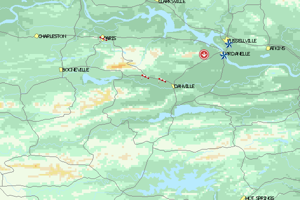
Umgebungskarte
  Fluggebiet  Flugschule  Aktuelle Position |
Fluggebiete in der Nähe (Radius: 50 km)
Nordamerika » USA » Arkansas
Entfernung:
23 km
Höhenuntersch.:
15
Meter
Ort:
Belleville
Streckenflug:
Nein
Startplatz:
Keine Angabe
Landeplatz:
Keine Angabe
Start Richtungen:
As the name suggest a small practice hill near the Belleville airport.
Nordamerika » USA » Arkansas
Entfernung:
28 km
Höhenuntersch.:
600
Meter
Ort:
Havana
Streckenflug:
Ja
Startplatz:
mittel
Landeplatz:
mittel
Start Richtungen:
Measuring 826m Mount Magazine measures as the highest mountain in Arkansas. In the surrounding State park, there is numerous possibilities for hiking, riding and camping. On the Labot Day weekend, an annual Fly-in takes place.
Nordamerika » USA » Arkansas
Entfernung:
44 km
Höhenuntersch.:
150
Meter
Ort:
Paris
Streckenflug:
Nein
Startplatz:
Keine Angabe
Landeplatz:
Keine Angabe
Start Richtungen:
Short Mountain in the vicinity of Paris is a quite simple flying mountain that is frequented mostly by Hang Gliders. Start direction is south west.
Flugschulen in der Nähe (Radius: 50 km)
Nordamerika » USA » Arkansas
SOARING WINGS
PO Box 817
US - 72834 Dardanelle (AR)
Entfernung: 9 km
Tony Middleton gewährt uns leider keinen virtuellen Einblick in sein Schulungsgelände. Aber: "Was nicht ist...
Nordamerika » USA » Arkansas
Central Arkansas Mountain Pilots
1300 E Russell # 30,
Russellville, Ar 72802 www.hang-glide.com
Entfernung: 12 km
Die Central Arkansas Mountain Pilots informieren nicht nur über die besten Seiten im Staate, sondern haben gleich auch Listen der dortigen...
Alle Fluggebiete und Flugschulen in der Nähe anzeigen
|