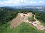
Pico do Urubu, 1140 Meter
          
Talort:
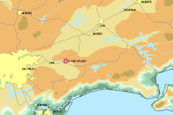
Mogi das Cruzes (Sao Paolo)
Höhe Talort:
770 Meter
Höhenunterschied:
436
Meter
Start Richtungen:
Seilbahn:
Nein
Streckenflug:
Ja
Soaring:
Keine Angabe
Windenschlepp:
Nein
Walk and Fly:
Keine Angabe
Ski and Fly:
Nein
Drachen:
Keine Angabe
UL:
Keine Angabe
Google Maps:
Qualität Fluggebiet:
Qualität dieser Seite:
Statistik:
Adoption (User):
-
Zuletzt bearbeitet:
20.08.2019
Anspruchsvolle Flugseite für erfahrene Piloten mit gutem Potenzial für Querfeldeinflüge.
Bewertung der Fluggebiets- und der Seitenqualität
Besonderheiten und Webcam
Alle Informationen über das Fluggebiet haben:
Gavea Skywalkers
+ 55 21 2494-7664 oder
+ 55 21 21 9193-3193
ppinto@gaveasky.com.br |
Walk and Fly
Ausgangspunkt:
Wegbeschreibung:
Sonstiges:
Wissenswertes
Anfahrt:
25km von Sao Paolo in Mogi das Cruzes (SP).
25 miles from SP on the Dutra road. Take the Mogi-Dutra road to Mogi; take the B exit right after a bridge, on the roundabout. Then, take the road to the left of the Clube Vila Santista and go uphill on a paved road. Go past the Tennis Club and keep going to the left on the next Y-passes. The access road is a good 3-mile, two-way brick road; when in the plateau, please park to the left.
Sonstiges:
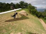
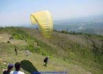
Startplätze
Startplatz:
Pico do Urubu
GPS-Koordinaten:
Startrichtung:

N S Schwierigkeit:
schwer
Höhe über NN:
1154
|
Landeplätze
Landeplatz:
Mogi das Cruzes
Schwierigkeit:
schwer
Höhe über NN:
718
|
Download: Google Earth Dateien für Fluggebiet und Flugdaten (IGC, OLC)
Download: Google Earth Dateien (KML-Format), Flugdaten (IGC Format)
Die letzten 3 Flüge
Leider keine OLC Daten vorhanden.
Flugdaten von www.paraglidingforum.com
Leider keine OLC Daten von www.paraglidingforum.com vorhanden.
Umgebungskarte
  Fluggebiet  Flugschule  Aktuelle Position |
Alle Fluggebiete und Flugschulen in der Nähe anzeigen
|