Laspi - Crimea, Ukraine, 460 Meter
          
Talort:
Sevastopol
Höhe Talort:
0 Meter
Höhenunterschied:
460
Meter
Start Richtungen:
Seilbahn:
Nein
Streckenflug:
Ja
Soaring:
Ja
Windenschlepp:
Nein
Walk and Fly:
Nein
Ski and Fly:
Nein
Drachen:
Nein
UL:
Keine Angabe
GPS Tal:
GPS Berg:
Qualität Fluggebiet:
Qualität dieser Seite:
Statistik:
Adoption (User):
ginger seit 03.02.2008
Zuletzt bearbeitet:
04.02.2008
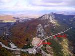
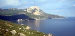
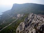
It's a flying site on the South Coast of Crimea. The take-off is situated above the bay of Laspi, in 10m under the highway. On the good sunny day it's easy to get 300-700 meters above the take-off and fly along the coast to Kush-Kaya mountain. Following its rocks you can fly 5-6 km from the take-off and back. Also there is possible XC-flights to the inner part of the Crimea. When an inversion is low, conditions can be rather turbulent.
Bewertung der Fluggebiets- und der Seitenqualität
Schwierigkeit
Landing area is on the roof of highway-tunnel, 15x180m, & along it electro-wires are stretched.
Alternative places for landing are small beaches, a Laspi's road or valleys behind the ridge of mountain.
Besonderheiten und Webcam
links:
http://www.crimea-paragliding.com/paraphotos.htm |
Startplätze
Startplatz:
Laspi
Startrichtung:

SO S SW Schwierigkeit:
mittel
Höhe über NN:
0
|
Landeplätze
|
Download: Google Earth Dateien für Fluggebiet und Flugdaten (IGC, OLC)
Download: Google Earth Dateien (KML-Format), Flugdaten (IGC Format)
Die letzten 3 Flüge
Leider keine OLC Daten vorhanden.
Flugdaten von www.paraglidingforum.com
Leider keine OLC Daten von www.paraglidingforum.com vorhanden.
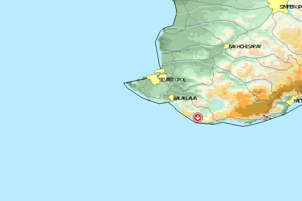
Umgebungskarte
  Fluggebiet  Flugschule  Aktuelle Position |
Fluggebiete in der Nähe (Radius: 50 km)
Europa »
Entfernung:
26 km
Höhenuntersch.:
1287
Meter
Ort:
Jalta
Streckenflug:
Ja
Startplatz:
mittel
Landeplatz:
mittel
Start Richtungen:
Direkt am wunderbaren und weltberühmten Kurot Jalta gelegen.
Alle Fluggebiete und Flugschulen in der Nähe anzeigen
|