Moses Rocks, 20 Meter


Talort:
Margaret River
Höhe Talort:
2 Meter
Höhenunterschied:
18
Meter
Start Richtungen:
Seilbahn:
Nein
Streckenflug:
Ja
Soaring:
Keine Angabe
Windenschlepp:
Nein
Walk and Fly:
Nein
Ski and Fly:
Nein
Drachen:
Keine Angabe
UL:
Ja
Google Maps:
Qualität Fluggebiet:
Qualität dieser Seite:
Statistik:
Adoption (User):
-
Zuletzt bearbeitet:
15.12.2005
Low coastal site with west wind and simple to access. In addition, nice coastal scenery and a terrific parking lot directly at the beach.
Bewertung der Fluggebiets- und der Seitenqualität
Flug
The beach is rocky, please be careful and look for a good place to start and land. Flying in the Northern or Southern direction is very beautiful for Paragliding.
Further to the North, it is more difficult and only hence is only suicted to experienced pilots. Because of the high reef it is only possible to land above.
Wissenswertes
Anfahrt:
Moses Rocks Road heads south von the Caves road along the coast, you will find it a few kilometers south of Injidup.
Sonstiges:
You will find Margaret River in the middle region of Bunbury and Cape Naturaliste, approx. 200km south of Perth. This lovely landscape offers all wind directions available at the coast side, by NE over W until S. The best time to fly is in the spring or autumn so to exploit the advantages of the western back wind or front wind. Also in the summer, flights over the lake are yet always very good
Startplätze
Startplatz:
Moses Rocks
Startrichtung:

W Schwierigkeit:
leicht
Höhe über NN:
20
|
Landeplätze
Landeplatz:
Moses Rocks
Schwierigkeit:
leicht
Höhe über NN:
0
|
Download: Google Earth Dateien für Fluggebiet und Flugdaten (IGC, OLC)
Download: Google Earth Dateien (KML-Format), Flugdaten (IGC Format)
Die letzten 3 Flüge
Leider keine OLC Daten vorhanden.
Flugdaten von www.paraglidingforum.com
Leider keine OLC Daten von www.paraglidingforum.com vorhanden.
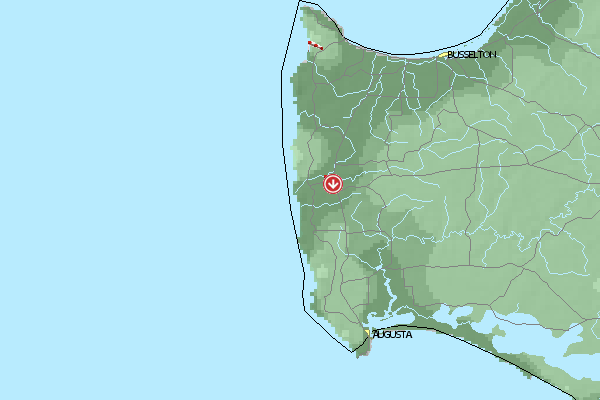
Umgebungskarte
  Fluggebiet  Flugschule  Aktuelle Position | Orte in der Nähe
Margaret River (0 km)
Bramley (6 km)
East Witchcliffe (9 km)
Cowaramup (9 km)
Witchcliffe (10 km)
Rosa Brook (11 km)
Forest Grove (13 km)
Yates, Mount (19 km)
Metricup (19 km)
Yelverton (22 km)
Arumvale (24 km)
Yallingup (28 km)
Karridale (30 km)
Carbunup (30 km)
Hamelin Island (30 km)
|
Fluggebiete in der Nähe (Radius: 50 km)
Australien / Ozeanien » Australien » Western Australia
Entfernung:
0 km
Höhenuntersch.:
198
Meter
Ort:
Margaret River
Streckenflug:
Ja
Startplatz:
schwer
Landeplatz:
leicht
Start Richtungen:
A high west facing mountain with good thermic conditions.
Australien / Ozeanien » Australien » Western Australia
Entfernung:
0 km
Höhenuntersch.:
8
Meter
Ort:
Margaret River
Streckenflug:
Ja
Startplatz:
sehr leicht
Landeplatz:
sehr leicht
Start Richtungen:
A long and flat section of coast with a soft sandy beach. In a western wind its possible to land on the naked bathers beach.
Australien / Ozeanien » Australien » Western Australia
Entfernung:
0 km
Höhenuntersch.:
8
Meter
Ort:
Margaret River
Streckenflug:
Ja
Startplatz:
sehr leicht
Landeplatz:
sehr leicht
Start Richtungen:
Very nice and beautiful coast with a lond beach- and naked beach. Mostly west winds!
Alle Fluggebiete und Flugschulen in der Nähe anzeigen