Greenhills, 80 Meter
          
Talort:
Margaret River
Höhe Talort:
2 Meter
Höhenunterschied:
0
Meter
Start Richtungen:
Seilbahn:
Nein
Streckenflug:
Ja
Soaring:
Keine Angabe
Windenschlepp:
Nein
Walk and Fly:
Nein
Ski and Fly:
Nein
Drachen:
Keine Angabe
UL:
Keine Angabe
Google Maps:
Qualität Fluggebiet:
Qualität dieser Seite:
Statistik:
Adoption (User):
-
Zuletzt bearbeitet:
13.12.2005
A lovley long coastal flying site with the best conditions for Paragliding!
Bewertung der Fluggebiets- und der Seitenqualität
20.09.2015
jWA475k0
In the event of intense overdosage treatment with nimodipine must be discontinued promptly. Emergency situation procedures ought to be governed by the symptoms. Stomach lavage with mehr
|
|
Flug
Good possibilities for starting because of the falling away coastal line and the thermic conditions. Therefore this site can be flown in both strong and easy winds.
Besonderheiten und Webcam
| Please take caution with the aeroplanes from the local airoplane club situated very close to the flight zone! |
Wissenswertes
Sonstiges:
You will find Margaret River in the middle region of Bunbury and Cape Naturaliste, approx. 200km south of Perth. This lovely landscape offers all wind directions available at the coast side, by NE over W until S. The best time to fly is in the spring or autumn so to exploit the advantages of the western back wind or front wind. Also in the summer, flights over the lake are yet always very good
Startplätze
Startplatz:
Greenhills
Startrichtung:

SW Schwierigkeit:
mittel
Höhe über NN:
80
Am besten einen Platz ohne viel Büsche suchen!
|
Landeplätze
Landeplatz:
Greenhills
Schwierigkeit:
mittel
Höhe über NN:
80
Es kann wieder oben als auch unten gelandet werden!
|
Download: Google Earth Dateien für Fluggebiet und Flugdaten (IGC, OLC)
Download: Google Earth Dateien (KML-Format), Flugdaten (IGC Format)
Die letzten 3 Flüge
Leider keine OLC Daten vorhanden.
Flugdaten von www.paraglidingforum.com
Leider keine OLC Daten von www.paraglidingforum.com vorhanden.
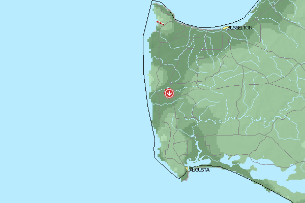
Umgebungskarte
  Fluggebiet  Flugschule  Aktuelle Position | Orte in der Nähe
Margaret River (0 km)
Bramley (6 km)
East Witchcliffe (9 km)
Cowaramup (9 km)
Witchcliffe (10 km)
Rosa Brook (11 km)
Forest Grove (13 km)
Yates, Mount (19 km)
Metricup (19 km)
Yelverton (22 km)
Arumvale (24 km)
Yallingup (28 km)
Karridale (30 km)
Carbunup (30 km)
Hamelin Island (30 km)
|
Fluggebiete in der Nähe (Radius: 50 km)
Australien / Ozeanien » Australien » Western Australia
Entfernung:
0 km
Höhenuntersch.:
198
Meter
Ort:
Margaret River
Streckenflug:
Ja
Startplatz:
schwer
Landeplatz:
leicht
Start Richtungen:
A high west facing mountain with good thermic conditions.
Australien / Ozeanien » Australien » Western Australia
Entfernung:
0 km
Höhenuntersch.:
8
Meter
Ort:
Margaret River
Streckenflug:
Ja
Startplatz:
sehr leicht
Landeplatz:
sehr leicht
Start Richtungen:
A long and flat section of coast with a soft sandy beach. In a western wind its possible to land on the naked bathers beach.
Australien / Ozeanien » Australien » Western Australia
Entfernung:
0 km
Höhenuntersch.:
8
Meter
Ort:
Margaret River
Streckenflug:
Ja
Startplatz:
sehr leicht
Landeplatz:
sehr leicht
Start Richtungen:
Very nice and beautiful coast with a lond beach- and naked beach. Mostly west winds!
Alle Fluggebiete und Flugschulen in der Nähe anzeigen
|