Whitfield Hill, 100 Meter
          
Talort:
Toodyay
Höhe Talort:
169 Meter
Höhenunterschied:
-69
Meter
Start Richtungen:
Seilbahn:
Nein
Streckenflug:
Ja
Soaring:
Keine Angabe
Windenschlepp:
Nein
Walk and Fly:
Nein
Ski and Fly:
Nein
Drachen:
Keine Angabe
UL:
Keine Angabe
Google Maps:
Qualität Fluggebiet:
Qualität dieser Seite:
Statistik:
Adoption (User):
-
Zuletzt bearbeitet:
15.12.2005
Easy high flying site in an easterly direction. Since 01 May 2003 the land has been privately owned and it therefore closed!
Bewertung der Fluggebiets- und der Seitenqualität
Flug
If the wind agrees, it makes flying, in spite of the difficult ascent alot of fun here A long and wide elevation provides for good thermal conditions. Top Landing is also no problem. When starting pay attention to the rocky underground. When landing take caution with the farm dam, it is very deep and one cannot get out one without aid!
Wissenswertes
Anfahrt:
The local Paragliding Club: Hill Soarers Club will be happy to provide you with information and tipps regarding this flying site near Toodyay, around 1.5 east of Perth.
Sonstiges:
In this area is apporx. 1 hour removed from Perth, you will find numerous flight zones with all wind variations in the area suitable for the beginner.
Startplätze
Startplatz:
Whitfield Hill
Startrichtung:

O Schwierigkeit:
leicht
Höhe über NN:
100
|
Landeplätze
Landeplatz:
Whitfield Hill
Schwierigkeit:
leicht
Höhe über NN:
0
|
Download: Google Earth Dateien für Fluggebiet und Flugdaten (IGC, OLC)
Download: Google Earth Dateien (KML-Format), Flugdaten (IGC Format)
Die letzten 3 Flüge
Leider keine OLC Daten vorhanden.
Flugdaten von www.paraglidingforum.com
Leider keine OLC Daten von www.paraglidingforum.com vorhanden.
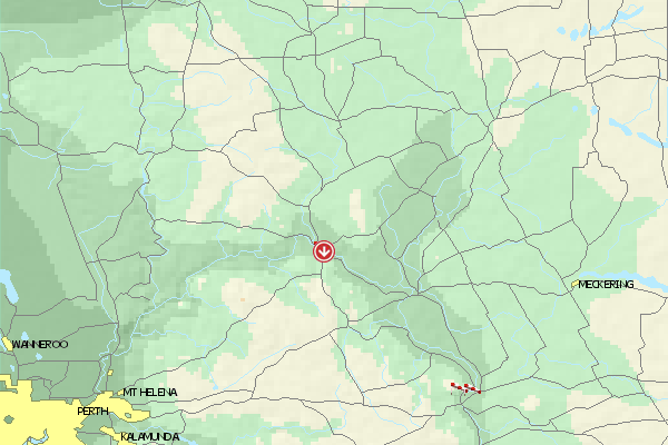
Umgebungskarte
  Fluggebiet  Flugschule  Aktuelle Position | Orte in der Nähe
Toodyay (0 km)
Lloyd Crossing (2 km)
Key Farm (4 km)
Nardee (5 km)
Nardie, Mount (5 km)
West Toodyay (5 km)
Ringa (6 km)
Coondle (8 km)
Dewars Pool (8 km)
Nunyle Hall (9 km)
Nunyle (9 km)
Hoddy Well (9 km)
Nanamoolan (11 km)
Culham (15 km)
Wongamine (16 km)
|
Fluggebiete in der Nähe (Radius: 50 km)
Australien / Ozeanien » Australien » Western Australia
Entfernung:
0 km
Höhenuntersch.:
108
Meter
Ort:
Perth
Streckenflug:
Ja
Startplatz:
schwer
Landeplatz:
leicht
Start Richtungen:
You will find this site exaclty NE between Toodyay and Northam in the Avon Valley. This site is not particularly east to fly from due to the trees and the fast changing thermic conditions. The site is owned by farm owners Bruce and Carolyn, who gladly support the sport.
Site Closed...
Australien / Ozeanien » Australien » Western Australia
Entfernung:
0 km
Höhenuntersch.:
0
Meter
Ort:
Perth
Streckenflug:
Ja
Startplatz:
mittel
Landeplatz:
mittel
Start Richtungen:
NW flying site on Noodeening Hill. Quite small, but very nice and open site with good thermic conditions. In addition one can land above again above because the landing fields below are sprinkled with trees.
Site Closed
Australien / Ozeanien » Australien » Western Australia
Entfernung:
0 km
Höhenuntersch.:
-69
Meter
Ort:
Toodyay
Streckenflug:
Ja
Startplatz:
mittel
Landeplatz:
leicht
Start Richtungen:
A small flying site with not alot of landing possibilities and alot of powerlines/poles.
Alle Fluggebiete und Flugschulen in der Nähe anzeigen
|