Wyalkatchem, 0 Meter
          
Talort:
Toodyay
Höhe Talort:
169 Meter
Höhenunterschied:
-169
Meter
Start Richtungen:
Seilbahn:
Nein
Streckenflug:
Ja
Soaring:
Keine Angabe
Windenschlepp:
Nein
Walk and Fly:
Nein
Ski and Fly:
Nein
Drachen:
Keine Angabe
UL:
Keine Angabe
Google Maps:
Qualität Fluggebiet:
Qualität dieser Seite:
Statistik:
Adoption (User):
-
Zuletzt bearbeitet:
06.01.2006
The Western Soarers Hang Gliding club is 200 km east of Perth and is a competitive site with hoisting equiptment.
Bewertung der Fluggebiets- und der Seitenqualität
Flug
As you find yourself 200 km inland, the hoist here is considerably stronger and higher than at z. B. in York near the flight zones. Each direction for flying is possible, the starting place is from the Western Soarers Hangliding club, in order to reach the optimal Cross-Country Hang Glider-combination!
Besonderheiten und Webcam
| The Western Soarers Hangliding club or the Skysports Flying School possesses the current opening times. In high fire danger, for example the place is completely blocked. |
Wissenswertes
Anfahrt:
From Perth drive to Toodyay then right after the first Roadhouse, continue until you reach Goomalling and Dowerin, always in the direction of Wyalkatchem. When you arrive in the town you must contact the Western Soarers Hang Gliding Club or Skysports flying school and inquire regarding the flying situation.
Startplätze
Startplatz:
Wyalkatchem
Startrichtung:

N NO O SO S SW W NW Schwierigkeit:
sehr leicht
Höhe über NN:
0
|
Landeplätze
Landeplatz:
Wyalkatchem
Schwierigkeit:
sehr leicht
Höhe über NN:
0
|
Download: Google Earth Dateien für Fluggebiet und Flugdaten (IGC, OLC)
Download: Google Earth Dateien (KML-Format), Flugdaten (IGC Format)
Die letzten 3 Flüge
Leider keine OLC Daten vorhanden.
Flugdaten von www.paraglidingforum.com
Leider keine OLC Daten von www.paraglidingforum.com vorhanden.
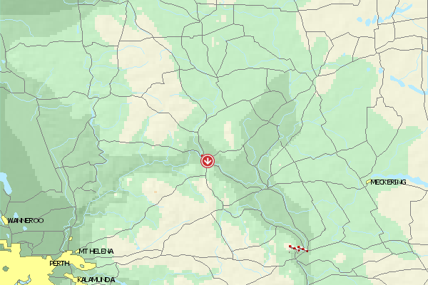
Umgebungskarte
  Fluggebiet  Flugschule  Aktuelle Position | Orte in der Nähe
Toodyay (0 km)
Lloyd Crossing (2 km)
Key Farm (4 km)
Nardee (5 km)
Nardie, Mount (5 km)
West Toodyay (5 km)
Ringa (6 km)
Coondle (8 km)
Dewars Pool (8 km)
Nunyle Hall (9 km)
Nunyle (9 km)
Hoddy Well (9 km)
Nanamoolan (11 km)
Culham (15 km)
Wongamine (16 km)
|
Fluggebiete in der Nähe (Radius: 50 km)
Australien / Ozeanien » Australien » Western Australia
Entfernung:
0 km
Höhenuntersch.:
108
Meter
Ort:
Perth
Streckenflug:
Ja
Startplatz:
schwer
Landeplatz:
leicht
Start Richtungen:
You will find this site exaclty NE between Toodyay and Northam in the Avon Valley. This site is not particularly east to fly from due to the trees and the fast changing thermic conditions. The site is owned by farm owners Bruce and Carolyn, who gladly support the sport.
Site Closed...
Australien / Ozeanien » Australien » Western Australia
Entfernung:
0 km
Höhenuntersch.:
0
Meter
Ort:
Perth
Streckenflug:
Ja
Startplatz:
mittel
Landeplatz:
mittel
Start Richtungen:
NW flying site on Noodeening Hill. Quite small, but very nice and open site with good thermic conditions. In addition one can land above again above because the landing fields below are sprinkled with trees.
Site Closed
Australien / Ozeanien » Australien » Western Australia
Entfernung:
0 km
Höhenuntersch.:
-69
Meter
Ort:
Toodyay
Streckenflug:
Ja
Startplatz:
mittel
Landeplatz:
leicht
Start Richtungen:
A small flying site with not alot of landing possibilities and alot of powerlines/poles.
Alle Fluggebiete und Flugschulen in der Nähe anzeigen
|